| نصب | <۱۰ |
| از ۰ رأی | ۰ |
| دستهبندی | آموزش |
| حجم | ۱۷ مگابایت |
| آخرین بروزرسانی | ۱۰ تیر ۱۴۰۳ |

| نصب | <۱۰ |
| از ۰ رأی | ۰ |
| دستهبندی | آموزش |
| حجم | ۱۷ مگابایت |
| آخرین بروزرسانی | ۱۰ تیر ۱۴۰۳ |
تصاویر برنامه


معرفی برنامه
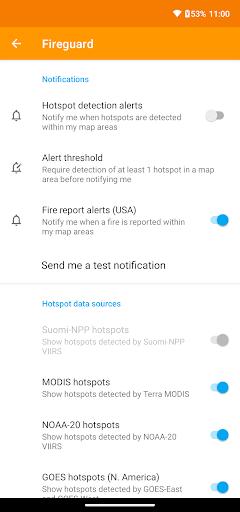
Get a powerful wildfire activity tracking map.
See details of fire activity overlaid on a single map:
• Hotspots identified by satellite-based sensors
• US & Canada wildfire incident reports
• Wildfire burned area boundaries
• Crowdsourced fire report markers
• NOAA smoke areas
• Cal Fire incident detail
• Fire weather risk areas
• Fire cameras
• Real-time traffic conditions
• Satellite ground tracks
Use this app to:
★ Track fire locations and progression
★ Monitor facilities/equipment in remote locations
★ Identify and avoid fire danger areas
Useful for:
• Natural resource managers
• Public utilities and telecom providers
• Anyone living or working in wildfire-prone areas
No login or registration required.
QUICK START: Open app and tap on "Fires near me"
Ad-supported. If you like the app, please consider making the one-time upgrade purchase to unlock bonus features and disable advertising.


