- Applications
- Tools
قطب نما و قبله یاب محلی
Images


Introduction
Explanation
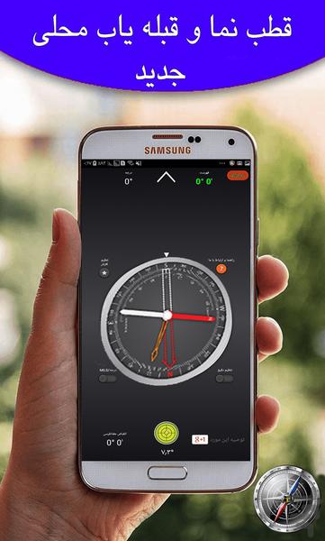
Compass and Qibla Locator
Determine the exact direction of the qibla without compass and GPS
And a treadmill for accurate use of the compass
Its online part determines the position of your shariah, which times your cities are closest to
It happens very well when we stop when we go to prayer, but because we are entering a new environment, we do not know the Qibla, although there are several ways to diagnose the qibla, but since they may not be familiar with them, So, it lets you install this software using your mobile phone's sensors.
Using the Qibla Screen, you can find the precise direction of the Qibla without compass and GPS. Using the gyroscope sensor on your Android device and using the grip of the city in which you are present, this software will show the direction of the Qibla without error. Gives.
Full Software Training
Before you start using the compass
Each time you open the compass, shake your device several times around your three axes to increase accuracy.
If your phone or tablet is protected by a magnetic coating, cover it before using the compass.
To rotate the compass or orientation, place two fingers on the screen at the same time and rotate it.
Set Magnetic Deviation
1. Find the current religious prayers for your location. You can get this link. Click this
2. Press the setup button.
3. Adjust the magnetic angle by rotating the arrow. You can set the exact mode by activating it.
4. Press the tuning button again to avoid the directional arrow.
5. You can also press the (Sensitive Setting) button to change between resetting and obtaining the default value for your area.
Set Magnetic adjustment
Press and hold the slider adjustment button to set Magnetic Reset.
Find where you are on the map
1. Look around and select the distant objects you can identify on your map.
2. Select the selected elements on the map.
3. Remove the map.
4. To target the first object.
5. Rotate the angle to align the direction with the magnetic needle.
6. Place the device on the map and drag the line along the edge through the symbol of the first object.
7. Repeat step 4 for the second object.
8. The intersection of the two lines shows your approximate position. If you repeat this process with a third object, the intersection of these three lines leads to a triangle, your approximate position on the map inside the triangle.
Measure the gradient of the Earth
1. Rotate the angle to align the east mark or the west mark with the index sign.
2. Put the device on the floor and align it with the largest slope.
3. See the value of the gradient shown by the colonorder needle on the internal scale of the compass.
Contact us with our email
fatahamirhasan@gmail.com


